
The geography of Saudi Arabia is really fascinating! After all, the kingdom features great deserts, magnificent mountains, fertile plains, as well as extensive coastlines. Besides, it is located in West Asia and is the largest country on the Arabian Peninsula. And how much area does the country cover? Which countries does it share a border with? What are the important land resources? Well, there is so much more you should know about Saudi Arabia. So, read till the end and find out the geographical wonders of this country.
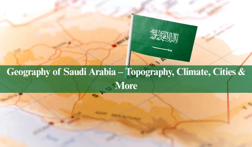
All About the Geography of Saudi Arabia
Saudi Arabia holds global importance because it’s the birthplace of Islam and Holy Kab’ah is there. Also, it is home to important cities such as Jeddah, Mecca, and Medina, as well as its capital Riyadh. However, another thing that gives the country a spotlight is its geographical diversity. From deserts to mountains and coasts, you can find everything here.
Did You Know?
Saudi Arabia comprises four-fifths or around 80% of the Arabian Peninsula. – Embassy, KSA
Interested in Arabian geographics? Or planning a trip to Saudi Arabia? If so, here is an all-you-need-to-know guide about this awe-inspiring kingdom.
What’s the Total Area of Saudi Arabia?
Saudi Arabia is the fifth largest country in Asia with a total area of 2,150,000 square kilometers (830,000 sq miles). Moreover, it consists of around 285 countries and a lot of towns. Almost all the cities and towns hold cultural, religious, and historical significance. Also, you should know that Riyadh is the capital of the Kingdom of Saudi Arabia. Besides, Mecca and Medina are among the holiest cities in the world. Muslims from around the world pay visits to these cities to perform Umrah and Hajj.
Important Info!
Apart from being the capital, Riyadh is also the largest city of KSA with 1,550 square km area.
The Borders & Boundaries of Saudi Arabia
You should know that Saudi Arabia shares land borders with seven countries and three water bodies. This is what makes this country so dynamic in terms of location. Moreover, the location also opens doors for many trade and travel opportunities. Anyway, let’s talk about the boundary-sharing countries now. Saudi Arabia shares its northern borders with Jordan, Iraq, and Kuwait. Furthermore, its eastern borders connect with the Persian Gulf, Qatar, the United Arab Emirates, and Oman. And you should also know that Oman lies in the southeast. To the south and southwest, it is bordered by Yemen, and to the west, it meets the Red Sea and the Gulf of Aqaba.
Are You Aware?
Saudi borders with Oman and the Republic of Yemen were defined after the resolution of disputes with these countries. However, borders with the UAE still remain undefined.
Here is a comprehensive breakdown of the countries and water bodies sharing boundaries with Saudi Arabia:
|
Boundaries of Saudi Arabia |
|
| Directions |
Borders |
| North | Iraq, Jordan, Kuwait |
| East | Qatar, UAE, Oman, Persian Gulf |
| West | Red Sea, Gulf of Aqaba |
| South | Yemen |
| Southwest | Yemen |
| Southeast | Oman |
What are the Geographical Features of Saudi Arabia?
As aforementioned, the geography of Saudi Arabia is rich. After all, it includes a variety of deserts, mountains, plateaus, coastal plains, valleys, and whatnot. You can really find a range of landforms here. Most people think that the country only comprises of deserts. However, it’s not true. If you are a tourist ready to explore the Saudi kingdom, having knowledge about these can help you big time.
Fun Fact!
“Saudi Arabia is the largest country in the world with no river.” – The World Factbook, CIA.
Anyway, let’s get into the details of the geography of Saudi Arabia. Here is all you need to know about the mountain ranges, coastal lines, desserts, and more.
|
Geographical Chart of Saudi Arabia |
|||
| Mountains | Deserts | Plateaus |
Coastal Plains |
| Asir
Hejaz Sarawat Midian |
Rub’ al Khali
An’ Nafud Ad’ Dahna |
Hasma
Al-Najd Al-Summan Al-Hammad Al Hujrah |
Tihama Plain
Arabian Gulf Plain |
| Climate Patterns in Saudi Arabia | Temperature in Saudi Arabia |
| Desert
Semi-desert Highlands |
Highest: 52 °C
Lowest: 08 °C |
Mountain Ranges
You should know that Saudi Arabia is home to several mountain ranges and some of the most notable peaks. Moreover, these mountains play an important role in the geography, climate, and culture of the country. Here is an overview of the mountain ranges:
- Asir
- Hejaz
- As-Sarawat
- Midian
Quick Question: What is the highest mountain peak in Saudi Arabia?
You should know that Mount Sawda (جَبَل ٱلسُّوْدَة) is the highest mountain peak of the Kingdom of Saudi Arabia. It is 3015 meters or 9892 ft. high. Moreover, it got this title officially from the official Saudi authorities.
-
Asir Mountains
Also known as جِبَال عَسِيْر in Arabic, these mountain ranges are in the southwestern part of the country, bordering some of its areas with Yemen. Moreover, the range runs parallel to the Red Sea. You should know that these feature some of the tallest mountains in Saudi Arabia. Furthermore, the highest peak of Asir is Jabal Sawda (جَبَل ٱلسُّوْدَة) with a height of around 3,015 meters. What’s more, the region enjoys a temperate climate. Yes, that’s right! Unlike most areas in the country, you can expect significant rainfall here. Therefore, the mountains have lush greenery, as well as diverse flora and fauna. Also, The Asir region is home to several traditional villages. Plus, the area is popular for agriculture too!
-
Hejaz Mountains
The Hejaz range or Jibāl al-Ḥijāz (جِبَال ٱلْحِجَاز) runs parallel to the western coast of Saudi Arabia. Also, you should know that one of the most notable peaks of Hejaz is Jabal Warqaan with a 2,393 m elevation. Most importantly, you should know that these mountain ranges hold a lot of religious significance. After all, the Hejaz region is where the holy cities of Makkah and Madina are located. Moreover, the region also has been a major trade route for centuries – and it still is. Talking about wildlife, there have been sightings of Arabian leopards here in the past times. Apart from this, you can see Hamadryas baboons too.
-
Sarawat Mountains
The Sarawat range or جِبَالُ ٱلسَّرَوَاتِ is located in the Hejaz region, along the western part of the Arabian Peninsula. They are often considered a continuation of the Asir mountains. Anyways, they start in the city of Taif and run along the entire western coast of Yemen. In other words, the range goes beyond the boundaries of Saudi Arabia – to Yemen. You should know that Sarawat mainly contains volcanic and sedimentary rocks with some green wadis that face the monsoons. Moreover, these areas are quite favorable for agriculture.
-
Midiyan Mountains
The Midiyan Mountains or مَدْيَن is a significant mountain range located in the northwestern part of the Arabian Peninsula or the Tabuk province of Saudi Arabia. Most people don’t know this, but this range is an important part of the geography of Saudi Arabia. After all, it features many notable mountain peaks in the country. Moreover, people often consider the Madin Mountains a part of either the Hejaz or Sawarat ranges. Furthermore, the mountains have an association with the Quranic and Biblical scripture. You should also know that the climate of this region is usually cooler than the surrounding deserts. And you can also find some vegetation here.
Deserts
Undoubtedly, deserts play an important part in the geography of Saudi Arabia. In fact, many people think that it is actually a desert. After all, the deserts of this country cover more than half of its total area. Besides, Saudi Arabia has three main deserts, namely:
- Rub’ al Khali
- An’ Nafud
- Ad’ Dahna
Let’s discuss how all these three impact the geographics of this country:
-
Rub’ al Khali
Also known as ٱلرُّبْع ٱلْخَالِي in Arabic or the Empty Quarter is the largest continuous sand desert in the world. You should know that it is almost 1000 km in length and 500 km in width. Astounding, right? Well, it also has sand dunes with heights of around 250 meters. Anyway, most of the desert is inhabitable because of the extreme weather conditions. Still, many animal and plant species grow and survive here. Furthermore, it doesn’t just cover Saudi Arabia. Apart from it, the Rub’ al Khali also extends to Oman, Yemen, and the UAE.
-
An’ Nafud
The Nafud desert or صحراء النفود is in the Northern Saudi Arabia, near the city of Al-Jouf. Moreover, the highlight of this desert is its brick-red sand dunes and rocky plateaus. Also, it covers an area of around 103,600 square kilometers, with some gravel plains along with sand dunes. You should know that Al-Nafud is also known for its archaeological sites. You have so much to explore about the past civilizations here. As for the climate, the desert experiences seasonal rainfall with a little bit of vegetation and the formation of temporary lakes.
Fun Fact!
An 85,000-year-old fossilized human finger was found in the An’ Nafud desert in 2016.
-
Ad’ Dahna
Another desert that is important in the geography of Saudi Arabia is Ad-Dahna. Unlike the above ones, Ad-Dahna is a narrow strip of sand desert. And it runs parallel to the eastern edge of the Rub’ al Khali. Moreover, its length spans over 1000km and it is around 80km wide. Also, the sand contains iron oxides. This is why it is red in color. Furthermore, it also features some of the most historical trade routes. You should know that these routes connect the desert with different regions of the Arabian Peninsula. Also, it’s home to wildlife, such as gazelles and desert foxes.
Plateaus
By now, you know that the geography of Saudi Arabia has so all ups and downs – quite literally. Let’s talk about the plateaus. After all, they also have a significant place in the topography of this country. Some of the major plateau areas include:
- Hasma
- Al-Najd
- Al-Summan
- Al-Hammad & Al Hujrah
Here is a little overview of all of these on the list:
-
Al-Najd Plateau
Undoubtedly, the Najd Plateau is one of the most significant geographical features in Saudi Arabia. In fact, it is the largest plateau in the Kingdom. You should know that the region is divided into two sections: Alia Najd and Lower Najd. Besides, Al-Najd has an elevated terrain with some areas of about 900 meters above sea level. Also, the plateau is popular for its rocky outcrops, gravel plains, and very occasional hills.
-
Hasma Plateau
You can find this plateau in the northwest of the Kingdom and is part of the larger desert landscape of the region. Moreover, it’s known for its rocky terrain and unique geological formations. Besides, the plateau is relatively arid, with a very little vegetation. However, it has historical significance as a route for trade and migration.
-
Al-Summan Plateau
The Al-Summan Plateau stretches about 1,000 kilometers from the borders with Kuwait and Iraq in the north to the Empty Quarter desert in the south. Also, it contains the gravel plains like the Al-Dabdeba Plain, and deep depressions called Al-Dahul. Apart from this, Al-Summan has valleys such as Wadi Al-Batin and Wadi Al-Sarar. And this is not all! The area also features the history of nomadic tribes that lived here once.
-
Al-Hammad and Al-Hujrah Plateaus
Both of these are located in the far north of Saudi Arabia. Like other plateaus, these two are also popular because of their geological features and the presence of ancient trade routes. Anyhow, the plateaus also feature valleys, water paths, as well as orients toward the north. As for their height, the Al-Hammad Plateau is around 650 to 900 m. Meanwhile, the Hujrah plateau has elevations of almost 400 to 560 m above sea level.
Other than the above, here is a list of some more significant plateaus of the Kingdom.
| Other Saudi Plateaus | |
|
|
|
|
|
Coastal Plains
We have discussed almost all the physical features important to the geography of Saudi Arabia. But one thing is yet to be discussed: the coastal plains. You should know that these are divided into two regions:
- Tihama Plain
- Arabian Gulf Plain
Keep reading to know more about how these coastal regions impact the topography of the kingdom:
-
Tihama Plain
The Tihama Plain, also called the Red Sea coastal plain, is an important area in Saudi Arabia. Moreover, the plain is wide in the south but gets narrower as it goes north to the Aqaba Gulf. Moreover, the coastal area has two parts:
- Tihāmat Al-Ḥijāz in the north
- Tihāmat ʿAsīr in the south
Besides, the Tihama Plain has many inlets that are good for sailing. However, it does not have natural harbors for large ships. In the southern part of the plain, there are many islands that add to its beauty.
-
Arabian Gulf Plain
The Arabian Gulf coast of Saudi Arabia is a broad coastal plain with about 700 kilometers along the Persian Gulf. Besides, this area features flat terrain that gradually flattens eastward. Also, it has sandy shores that are exposed at low tide. Additionally, this region is home to Saudi Arabia’s rich oil fields. You should know that these have contributed to the country’s petroleum wealth since the 1960s. Despite extreme environmental conditions, the Gulf supports diverse coastal and marine ecosystems.
What is the Climate in Saudi Arabia?
There are three seasons in Saudi Arabia: summer, winter, and spring (for a very short time). You should know that the Saudi Kingdom follows a desert climate pattern. This means, it experiences high temperatures during the day and low at night. There are also regions of semi-desert and subtropical highland climates. Moreover, climate is a major factor to consider in the geography of the country. Here is a breakdown of the climatic zones:
|
Climatic Zones in Saudi Arabia |
||
| Desert Zone | Steppe Zone |
Highland Climate |
| Covers most of the country, with extreme temperatures and minimal rainfall. | Includes western highlands with slightly more precipitation and vegetation. | Mostly includes the Asir region, with milder temperatures and more rainfall. |
Some regions also experience rainfall. In fact, the country has recorded a maximum annual rainfall of 65mm around coastal areas. If you are a tourist, you should know the climate impact on the geography of Saudi Arabia. After all, this will help you assess what to expect when you get there.
Did You Know?
The temperature of Saudi Arabia can go as high as 110°F in the summer and drops gradually as the weather changes to winter.
The Urban Geography of Saudi Arabia
The Kingdom of Saudi Arabia is one of the most notable cities in the world. Moreover, many cities and towns hold religious significance. Besides, most regions are a mix of ancient traditions and modern development. Let’s talk about the major cities and how they impact the geography of Saudi Arabia:
| Major Cities in Saudi Arabia |
|---|
|
Riyadh, the capital and largest city, is located in the central part of the country. Mecca and Medina are two major holy cities in Islam. After all, Mecca is home to the Kaaba, located within the Masjid al-Haram. Meanwhile, Medina houses the Masjid-e-Nabwi. Besides, Jeddah is the gateway to Mecca and Medina. Furthermore, Dammam serves as a commercial center and is a major connection for traders to the oil industry. All these cities play a part in the geography of Saudi Arabia in their own way.
Are You Aware?
Apart from being the capital, Riyadh is also the financial hub of Saudi Arabia.
Conclusion
If you have come reading this far, you know by now that the geography of Saudi Arabia is quite diverse. After all, it offers a mix of different landscapes, history, and cultural heritage. Furthermore, many think of the kingdom as just a desert. However, this is not true! In fact, the country is a land of mountains, coasts, plateaus, and valleys too. Whether you are a Saudi citizen or planning your tour to Saudi Arabia, the above geographical guide will help you a lot in exploring the country.